
 evergreen
 Summary
The initial route proposal for the San Francisco Streets project, completed in summer 2024.
🚧 This document is archived as of August 25, 2024. Some information may be outdated!
Introduction
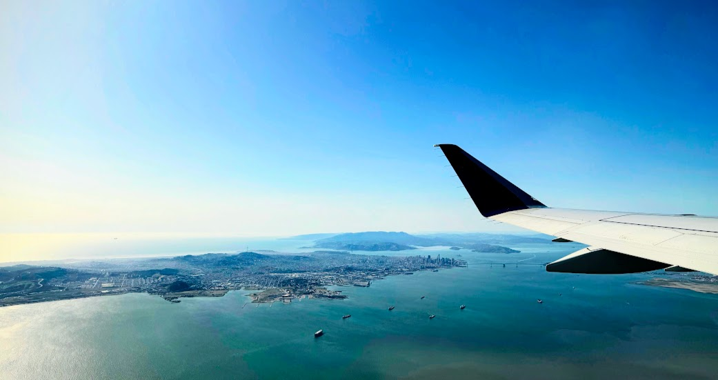
The San Francisco Streets Project aims to answer one question: Is it possible to walk through every major neighborhood in San Francisco in one day?
SF is a very unique city, given its shape as a 7-mile-by-7-mile square surrounded on three sides by water. It may well be the only large city in the United States in which this is possible.
This draft is a first attempt at a solution. The route starts off at the Bayshore Caltrain Station at 9am and ends it off walking along Ocean Beach at sunset, before we loop back to the BART line.
Anyone is welcome to join for any segment of the journey! The inaugural SFS tour will take place in early July. If you’re interested in being involved, contact me and include your phone number so I can add you to a WhatsApp group with live location sharing. You can meet us at any point in the day :)
A birds-eye view
11-12 hours total: Target arrival at Bayshore ~9am, arrival to Ocean Beach ~8:30pm (sunset time in early june)
- The northbound Caltrain gets into Bayshore at 8:44am.
6 main walking segments
- 6.5 hours to walk 16 miles (25 minute pace, casual walking)
- 3-4 hours of breaks for food and sightseeing
5 transit segments
- 20 mins on BART
- 20 mins on the T Line
- 20 mins on the K Line
- 50 mins on the 38R (in 2 parts)
1 rideshare segment
- 15 minutes
Neighborhood list
This route traverses the following neighborhoods in order:
Part 1
- Bayshore
- Sunnydale
- Visitacion Valley
- Excelsior
- Portola
- Bayview
- Hunters Point
Part 2 8. Dogpatch 9. Mission Bay 10. Potrero Hill 11. Mission District
Part 3 12. Glen Park 13. Twin Peaks 14. Noe Valley 15. Eureka Valley 16. The Castro 17. Duboce Triangle 18. The Haight 19. Hayes Valley 20. Fillmore District 21. Civic Center 22. Nob Hill 23. Tenderloin 24. Union Square
Part 4 25. SoMa 26. Financial District 27. The Embarcadero 28. Chinatown 29. North Beach 30. Russian Hill
Part 5 31. Fort Mason 32. Marina District 33. Pacific Heights 34. Japantown 35. Richmond District
Part 6 36. Outer Richmond 37. Sutro Heights 38. Golden Gate Park 39. Outer Sunset 40. West Portal 41. Balboa Park
Route Details
Part 1: Sunnydale/Visitacion Valley/Excelsior/Portola
1.25 hour walk, 3 miles.
-
Start: Bayshore Caltrain Station @ 9:00am
-
End: Gilman/Paul Station (T Line) @ 10:30am
-
includes a coffee stop at Mission Blue.

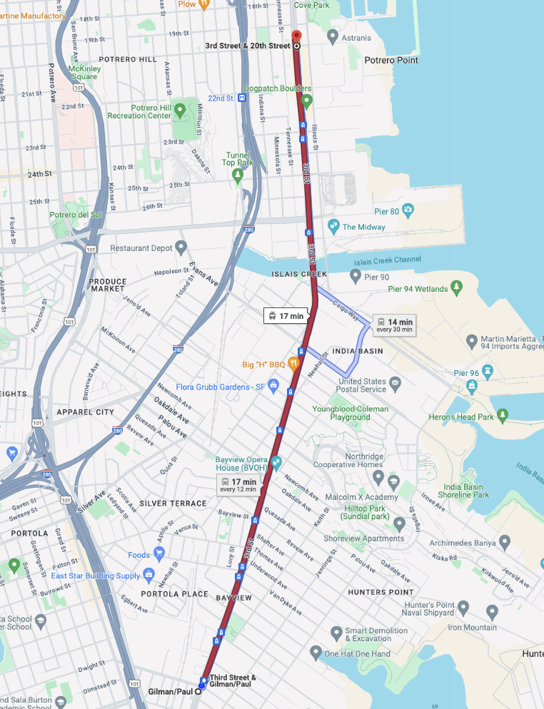
Part 1.5: Bayview/Hunters Point
15-minute T ride from Gilman/Paul to 20th Street.
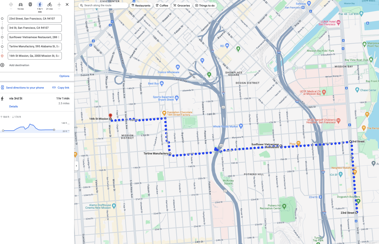
Part 2: Dogpatch/Mission Bay/Potrero Hill/Mission
1 hour walk, 1 hour break, 2.25 miles.
-
Start: 20th St x 3rd St @ 10:45am
-
End: 16th St/Mission BART Station @ 12:45pm
-
Lunch stop in Potrero Hill; there are several good options here.
-
Includes a pass by Tartine to grab some of the best baked goods in the city.
Part 2.5: BART from 16th/Mission to Glen Park
A brief 5-minute southbound hop on BART.
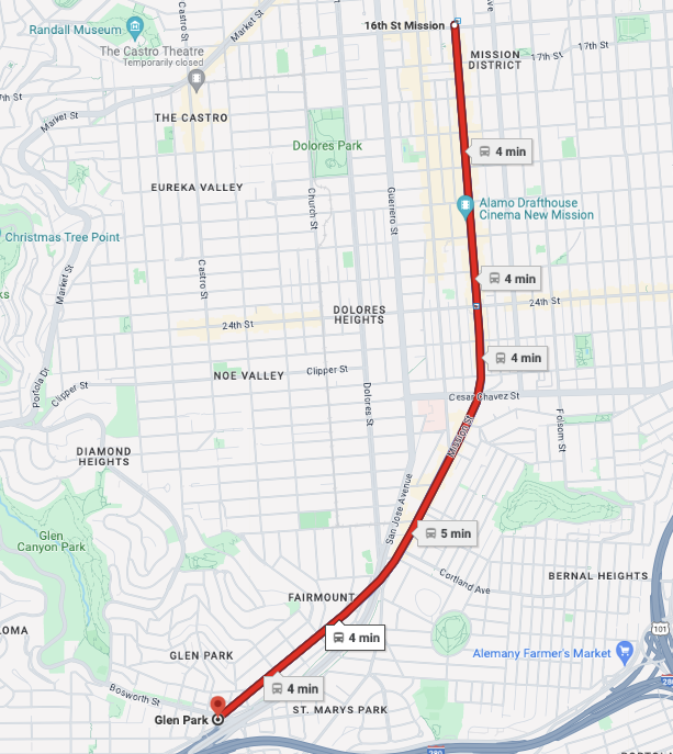
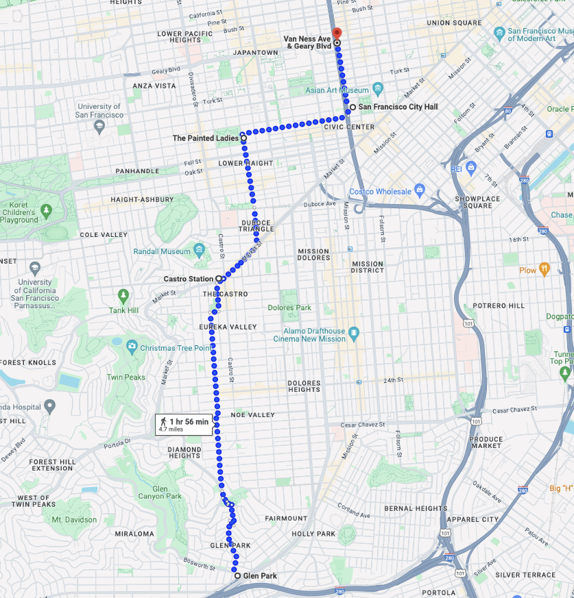
Part 3: Glen Park / Noe Valley / Twin Peaks / Castro / The Haight / Fillmore / Hayes Valley / Civic Center / Tenderloin / Nob Hill
2 hours, 5 miles of walking. This is the longest stretch!
-
Start: Glen Park BART Station @ 1:00pm
-
End: Van Ness x Geary @ 3:00pm
-
Some stops at the Painted Ladies and City Hall for some sightseeing.
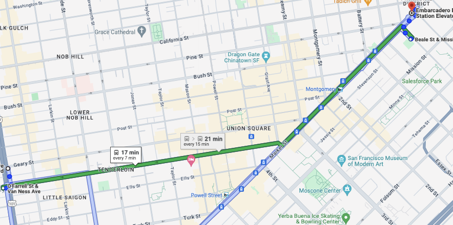
Part 3.5: Van Ness to Embarcardero via 38R
20 minute bus ride through the Tenderloin, Nob Hill, and Union Square along Geary and Market Streets.
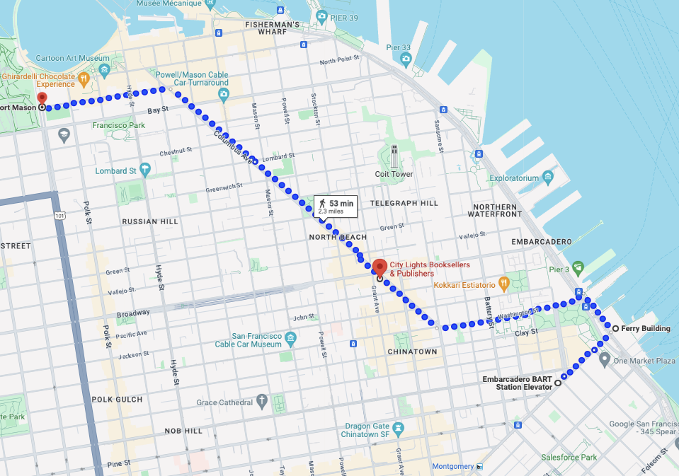
Part 4: SoMa/FiDi/Embarcadero/Chinatown/North Beach/Fort Mason
1 hour, 2.3 miles of walking.
-
Start: Embarcadero BART Station @ 3:30pm
-
End: Fort Mason @ 4:30pm
-
Passes by the Ferry Building.
-
Optional stops for snacks and drinks. There are some fantastic bakeries/delis all over North Beach.
-
Ice cream at Ghirardelli Square


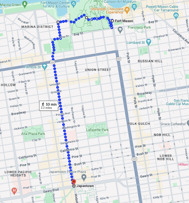
Part 5: Fort Mason to Japantown via Fillmore / Pacific Heights
1 hour leisurely walk over 2 miles, with a 1 hour dinner break at the end.
-
Start: Fort Mason @ 4:30pm
-
End: Japantown @ 6:30pm
-
Ogle at fancy mansions while gasping for breath going up the hill :)
-
Stop at Japantown for dinner.
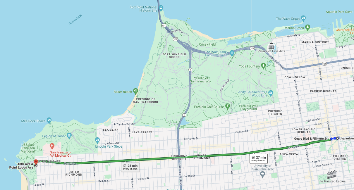
Part 5.5: Japantown/Richmond to Lands End via Geary/38R
30 minute bus ride (the 38R makes a reappearance!)
- Off-topic, but I really want to see a subway finally get built under Geary Street within my lifetime. One can dream

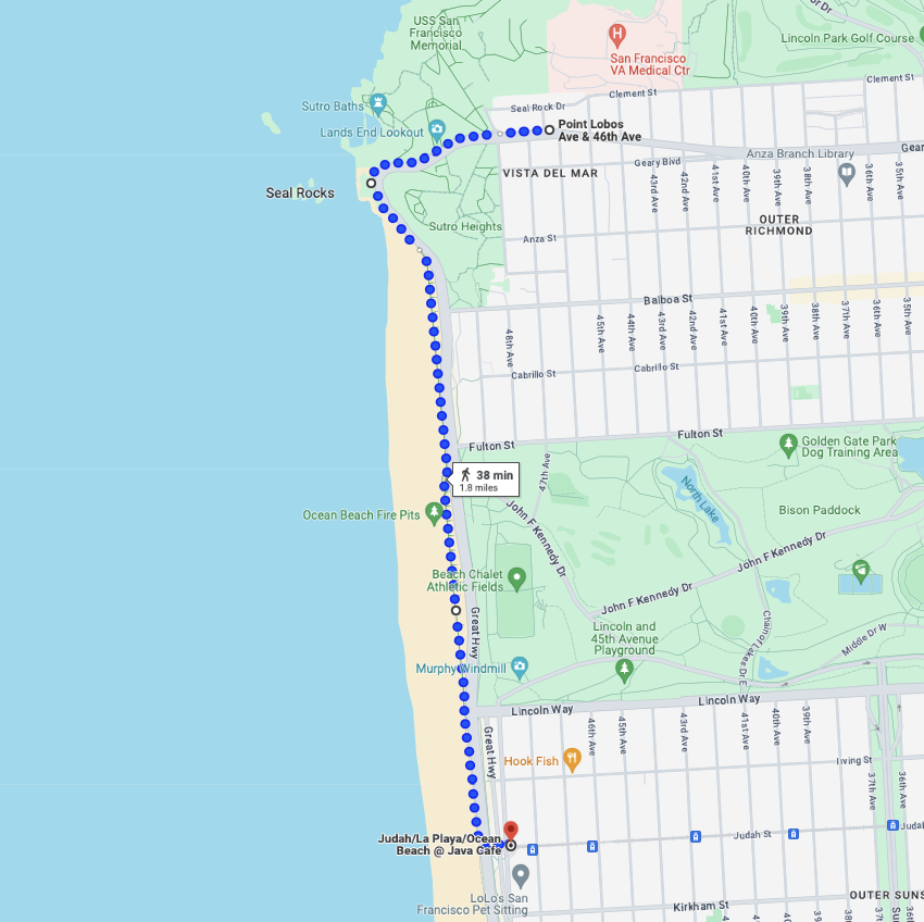
Part 6: Richmond to Sunset via GGP/Great Hwy
45 minutes, 1.5 miles. A super chill final stroll down the beach.
-
Start: Lands’ End @ 7pm
-
End: Judah x Ocean Beach @ 7:30pm
-
Hopefully the sun will start to set as we walk along this stretch! It will be super pretty.
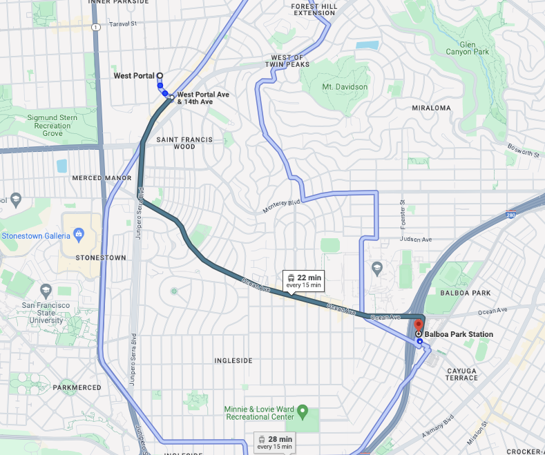
Part 6.5: catch a waymo to west portal
A nice 20 minute drive through the Sunset during sunset.
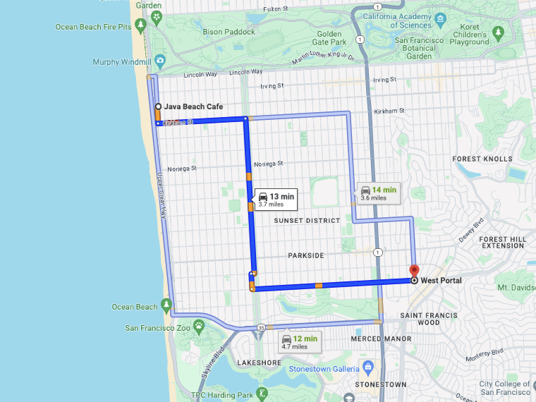
Part 6.75: West Portal to Balboa Park BART via K Line
25 minutes. Easy access to BART/Muni to get home.
Alternative Routes
SF has a lot of neighborhoods, and everyone has their own opinion on what counts, what they’re called, and where the boundaries are. I think this route does a good job of touching all of the most well-known subdivisions- but if there is something major I missed, let me know and I’ll tweak it for future iterations!
An improved or alternate route could include the following smaller neighborhoods and prominent landmarks:
- Ingleside/Outer Mission
- Add a small loop around Balboa Park at the end. Very doable if running ahead of schedule.
- Lakeshore (Lake Merced)/Parkmerced/SFSU/Stonestown
- Could detour the rideshare down here first before going to West Portal to add ~20 mins.
- Actual Twin Peaks
- You’d need some legs of steel to do the Twin Peaks hike in the middle of a 15-mile walk, but it’s on the route if you wish to attempt!
- Coit Tower
- Add a 20-minute extension to the middle of Part 4.
- Fisherman’s Wharf / Pier 39 / Ghirardelli Square
- Add a 30-minute extension to the end of Part 4.
- Palace of Fine Arts / Presidio / Golden Gate Bridge
- They’re deceptively far away. If you’re up to rent a bike and do a loop up between Phases 4 and 5, that would probably work the best.
- Actually going into SoMa (Oracle Park, Salesforce Park, etc)
- Before getting off at Dogpatch in Part 1.5, keep going all the way to 4th and King. Walk to Moscone Center along 4th Street, then take the T back to Dogpatch.
- Salesforce Park is a short walk from Embarcadero BART, and can be added as a loop before departing to Part 4.